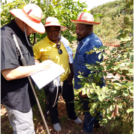
AIEC personnel with Hydrocarbon Imaging, Inc. personnel on the field

What We Do

AIEC with its technical partners offer world class Geology and Geophysical services to the Nigerian and African marketplace, using the best state of the art software technology, current state of the art hardware and a combination of the best international and local Nigerian specialists.
We have developed with our affiliates, a network of technical collaboration and with combined companies of over 100 years of experience in geoscience services, oil and gas reserves evaluation and production. We are staffed with international experts and strong local geoscientists to provide easily accessible and highest quality world class services to the governments and companies in Africa.


AIEC personnel with NUPRC staff and Hydrocarbon Imaging, Inc. team.


Acquisition, Exploration and Production
AIEC intends to build infrastructure as well as be involved in high-risk/high reward areas of Exploration and Production focusing on finding, augmenting and producing Oil and Gas.

Seismic Technology
AIEC offers a full range of Seismic technology acquisition services. Through the international experts supplied by our partners, AIEC can carry out the following:
Seismic acquisition services
- 2-D, 3-D and 4-DLand seismic Acquisition
- 2-D, 3-D and 4-D Marine Seismic Acquisition
We have extensive experience in survey and line cutting services utilizing the latest tools and technologies to ensure data accuracy. With deep expertise in any conceivable survey scenario, we utilize the latest tools and technologies to ensure accuracy.
Survey services comprise a critical element to the success of any given seismic acquisition project. Our exceptionally skilled seismic survey teams possess deep expertise in a variety of survey and line cutting services. We leverage the latest technologies to ensure accuracy. Even on collaborative seismic programs where the survey phase is completed by a third party vendor, we are adept at managing sub-contractors to ensure overall project timelines and quality benchmarks are being met.

Seismic Data Processing
AIEC offers a fully configured Seismic processing in Lagos Nigeria. This center consists Promax software for basic processing, and advanced modules for specialized processing including wavelet extraction, and attribute analysis. This center is operated on modern computing equipment that can be easily scaled as required for the work load of the center which include Innovative TsunamiTM Kirchoff PSTM/DM software designed exclusively for the latest Clustered Super Computers, wide range of prestack Time and Depth Migration techniques and powerful shared memory and clustered super computer resources.
AIEC E&P is into a full range of seismic processing services, from field records, to advanced imaging and inversion techniques. Our geoscientists have extensive experience in both 2-D and 3-D seismic processing and experience with near surface static corrections.
Some of the advanced processing services we offer are:
- Specialized seismic attribute processing
- Calibration of seismic response to reservoir properties
- Estimation of reservoir properties away from the borehole
- Seismic inversion
- Pore pressure prediction
- Tomographic studies for statics
Our processing geophysicists work closely with the seismic interpreters and geologists to assure
that the processing parameters are consistent with the geological objectives of the project.

Seismic Data Interpretation
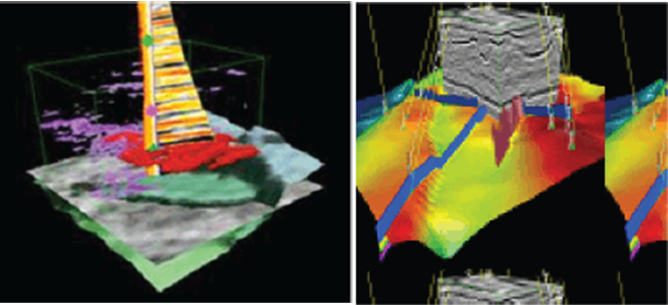
AIEC E&P Limited Geoscientists can offer a range of interpretations either to support the seismic processing activities or for client requested interpretation projects. These would include structural and stratigraphic interpretations of either 2-D or 3-D data. Our specialists can either develop regional or local structural framework, all the way to prospect generation and support of exploration decisions.
Our experts can generate structural maps, depth convert as necessary, generate isochore maps and overlay other geological information as available.
All of our international experts have many years of experience in many different geological settings, and we combine this expertise with local experts knowledgeable about the local depositional and structural patterns.

Remote Sensing (Satellite Imaging) Technology
A fast and cost effective way to cover large areas; this technology has the ability to see from the surface to a depth of many tens of thousands of feet.
It is a revolutionary technology that utilizes satellite imaging to explore the Earth and identify hydrocarbons, groundwater and solid mineral deposits in the subsurface. At the core of Remote Sensing is the study of interaction between the targeted substance and radiated energy. All subsurface deposits generate energy and leave unique Spectral Signatures that can be registered by satellite photographs.
Our partners use a multi-tool for exploration, combining hydrocarbon lead indicator tools and geological and geophysical lead indicator tools in order to maximize exploration effectiveness.
An example is Nuclear Magnetic Resonance that has;
– The ability to see from the surface to a depth of many tens of thousands of feet.
– The ability to see into the earth and discover unknown Oil or Gas deposits.
– The ability to see into the earth and discover the unknown, any Metal or Mineral deposit.
– The ability to see the size and depth of multi-level deposits hidden under a known deposit*.
– The ability to allow total 3D mapping of a deposit.
These are achieved using a physical property that occurs at the Subatomic Level of Physics, called Nuclear Magnetic Resonance (NMR). All elements have a distinct and unique NMR signature, as well as 7 resonant harmonic frequencies. Other applications of these NMR properties have been known and developed in other industries, such as the MRI in the medical field, and NMR is being used by large oil field service companies as an oil well logging technology in the borehole environment.
The technology team utilizes satellite imagery technology that can detect these frequencies emanating from the surface of the Earth, then uses a proprietary system of mathematical algorithms in the process of providing the final analysis and graphic presentation of the location of the target element in the survey, which includes the spatial location of the target element, as well as the depth of the element through additional survey data processing.
The advantage of this technology is, Satellite imaging technology is deployed remotely, and there is no need for permitting or on surface presence for data gathering. It involves rapid deployment and turn-around times. It can delineate where oil is located. Depth analysis can determine pay zone thickness and up dip/down dip orientation of sedimentary strata. In addition some structures may be discovered depending on trapping environment, that is, oil trapped on one side of a fault. Remote sensing technology can locate a subtle stratigraphic trap that contains oil (with pay zone thickness), and where to place the drilling location for best possible results

